Contrail forecasting case study
Background
SATAVIA can prevent aircraft contrails, eliminating up to 60% of aviation’s climate impact – that’s 2% of ALL human-induced climate impact!
Contrails are left behind by aircraft flying at high altitudes and are an everyday observable phenomenon. These “man-made” cirrus clouds can persist from seconds to hours, depending on the characteristics of temperature, humidity, wind, and the stability of the air aloft. Contrails that persist for several hours (and those that have significant horizontal spreading across the sky), are known to influence the radiation balance of the atmosphere, and, therefore, have potential global climate implications. In order to mitigate the overall impact of contrail-related clouds, understanding the aviation industry’s contribution to climate change is of vital importance.

Solution
SATAVIA has created a high-resolution (5km spatial resolution) regional climate model product to forecast the likelihood of contrail formation for flight corridors across Europe and Asia. We calculate the likelihood of contrail formation by comparing model-predicted temperature and humidity values to the critical values needed for their formation and maintenance. SATAVIA’s model could be used for short-term forecasts (up to 36 hours) of contrail layers. Contrail forecasts could be incorporated for flight planning purposes to intelligently re-route flights around those regions of the atmosphere that are susceptible to the effects of contrails.
Case study
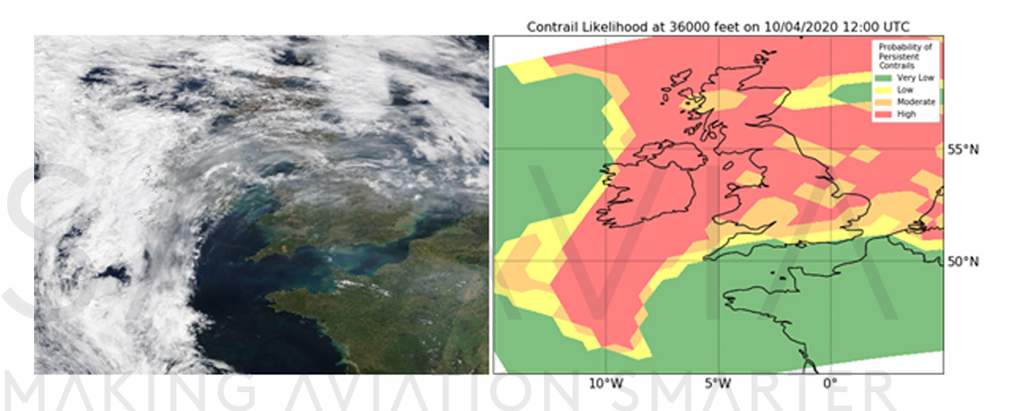
On 10 April 2020, high pressure conditions over Western Europe led to calm, blue skies over much of the United Kingdom. At approximately 1230 UTC, a contrail was observed and photographed by three different observers (see Fig. 1), lasting longer than 5 minutes. The aircraft was identified as a Boeing 747-830, at an altitude of 36000 feet at the time of observation.
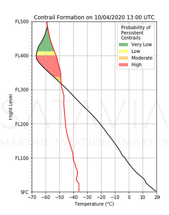
SATAVIA’s model predicted a layer of persistent contrails with high probability between 34000 and 40000 feet 1300 UTC (see Fig. 2). This is consistent with the visual observations at the time (Fig 1).
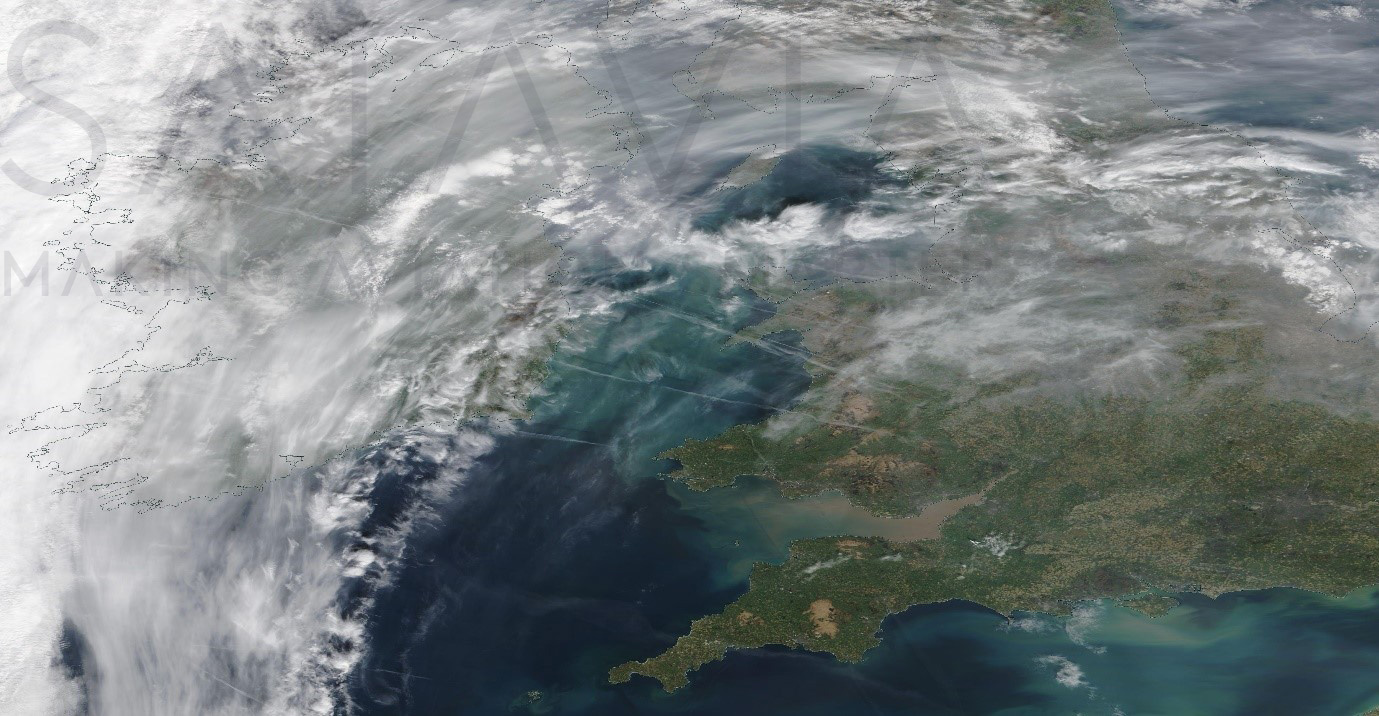
The nearest-in-time satellite imagery (Terra/MODIS) was approximately an hour earlier (at 11:41 UTC) than the photos shown in Fig.1 and clearly shows a series of persistent contrails left behind by several transatlantic flights over Wales and the Irish Sea (Fig 3). SATAVIA’s contrail prediction system predicted an extensive area of potential for long-lasting contrails over most of the British Isles near this time, yet near zero chance over northern France. This appears to match favourably with the satellite image.